The Great American Road Trip: Nebraska, South Dakota, Wyoming
- abundantlyclare

- Oct 22, 2021
- 11 min read
On July 10, we left Colorado for South Dakota via Nebraska. We made a quick pit stop along the way for a very important photo.

Had to get a photo with the Pawnee sign. Just call me Leslie Knope!
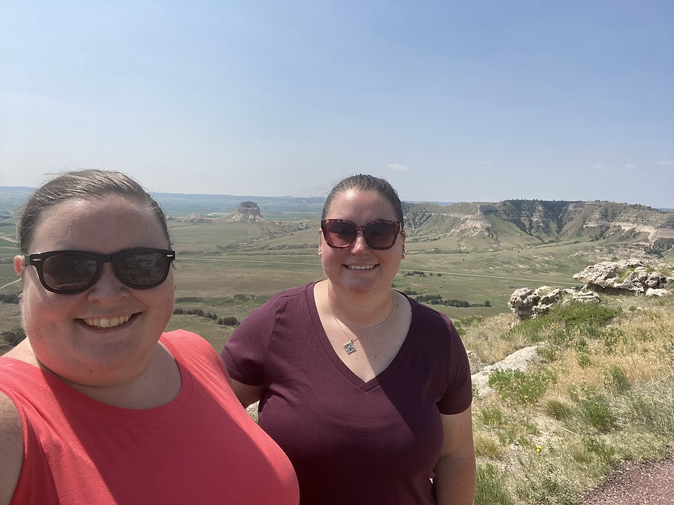
We basically drove almost due east from Greeley, across the northeastern corner of Colorado, then turned left and swung north into Nebraska. It was a 2.5 hour drive to the Scotts Bluff National Monument, our first stop of the day. In addition to the bluffs for which it's named, the National Monument protects "over 3,000 acres of historic overland trail remnants, mixed-grass prairie, rugged badlands, and riparian area along the North Platte River," according to its Wikipedia page. It's was also a landmark on the Pony Express Trail, Mormon Trail, and the Oregon Trail (thankfully, we didn't contract dysentery when we visited). I deeply appreciated that it's free, and you can drive to the top!

Scotts Bluff National Monument
Jule took this time lapse video of us driving to the top, for your viewing pleasure

On the way up

View from the top

The road leading to the bluff summit
At the top!
The last photo above is from the end of a very short trail to the edge of the bluffs. On the quick walk out there, we kept hearing noises in the grass, and we were joking that we had to stay clear of the rattlesnakes. After we drove back down to explore the visitor center, we learned that there are actually rattlesnakes who live at Scotts Bluff, all jokes aside, so thankfully we escaped without any snake bites!
We then drove into the town of Scottsbluff (Not a typo; the town is one word, the monument is two) to have a really delicious lunch at the Tangled Tumbleweed. We got a few small plates to share which included two local delicacies: lavash crackers and blue cornbread. I Googled lavash to describe it properly, and Google says it's a Middle Eastern flatbread, so I wondered why it is so popular in Nebraska, but apparently there is a growing Middle Eastern community out there, so that must be why. Things made of blue corn (like cornbread or tortillas, among other things I'm sure) are a delicacy out West so we were excited to try it, but Julia really didn't like it. We both loved the lavash though!
We then got back in the car and continued on to South Dakota to see the monument dedicated to Crazy Horse, a war leader of the Oglala Lakota who fought his whole life to protect his people from the US federal government. The monument has been under construction since 1948 and due to its massive size, it's still nowhere near done.

The Crazy Horse Memorial

There's a road leading up to the construction site but understandably visitors view it from the bottom

The model of what it's supposed to look like someday, and you can see a better cutout of the statue's arm in the back of the photo
Usually, I'm pretty good with logistics, but I made a mistake at this point. We left Crazy Horse to get our campsite set up at Custer State Park, because I was under the impression that Crazy Horse and Mount Rushmore were in opposite directions from our campsite. Unfortunately I was wrong, and we definitely should've gone to the campsite and got set up first, then visited Crazy Horse, then Mount Rushmore. My bad! So we got our campsite set up, doubled back and literally drove past Crazy Horse, and made it to Mount Rushmore late in the day so that we could stay for the evening lighting ceremony. Oops. Learn something new every day!
You can't see Crazy Horse without paying to ride out to it in a school bus with a tour guide, so the tour guide told us while we were out there that anyone who hadn't seen Mount Rushmore was destined for disappointment, because the presidents' faces on Mount Rushmore are only 60 feet high, and Crazy Horse's is 87. Well, nothing against that tour guide, but he was dead wrong. I seriously thought Mount Rushmore was the coolest, and it was the only place on our whole trip where I invested in a t-shirt!

At Mount Rushmore
I was just so impressed with the whole thing: the ingenuity to complete this crazy project, especially considering the time period (1927-1941), and the fact that the original sculptor had to be replaced by his son because of his untimely death (of a heart attack, nothing to do with the project), with such an incredible result. It was impossible not to compare to Crazy Horse, which definitely is a considerably larger project, but it's also been under construction since 1948.
We arrived late in the day to stay for the lighting ceremony, which is preceded by a little presentation full of patriotism about how America is and always has been superior (which Julia and I both absolutely hated, in case you were wondering), but seeing the sculpture lit up at night was worth the nonsense.

Mount Rushmore at night
We then headed back to Custer State Park to spend the night at our campsite, which was a hair-raising ride down winding, pitch-black, pothole-filled roads, which Julia managed heroically. The ridiculous ride was worth it though when we got out of the car and realized the stargazing was as good or better than any dark skies I've seen in the Pennsylvania wilds, so that was a nice reward!
In the morning, we explored a little bit of Custer State Park, which is nestled in the Black Hills and is absolutely beautiful. We had a close encounter with a bison, and we also stopped to take in some scenic overlooks. There are more beautiful views around every corner.

Our campsite in Custer State Park

A bison in the state park!

Views of the Black Hills (apparently so named by Native Americans because the evergreen trees made them look black from a distance)

Custer State Park
We then continued onto Badlands National Park, taking several dirt roads to get there (Admittedly I was not impressed by the state of the roads in South Dakota), but once we got there, we quickly stumbled upon Prairie Dog Town, so the dirt roads were obviously well worth it.
Prairie dog digging


We then continued farther into the park, and stopped at so many overlooks I lost track. The views go on forever at Badlands!


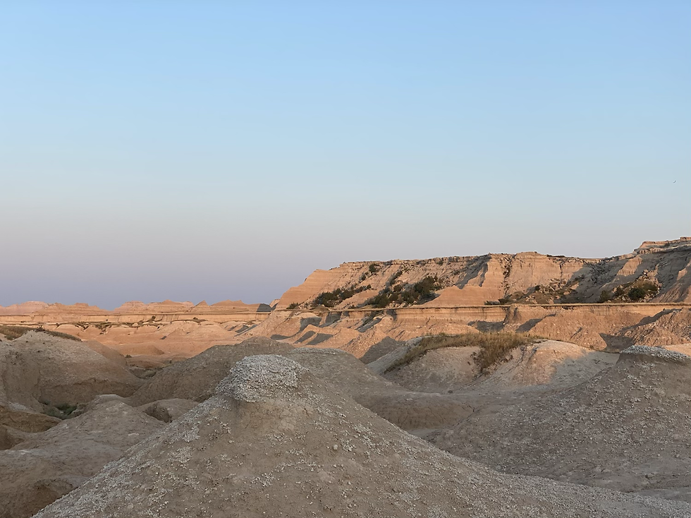
We had a picnic lunch near the visitor center, then went over to our campsite to get set up. That day in Badlands was one of the only days on the trip that I remember being uncomfortably hot. Julia struggles with heat more than I do, and she was honestly pretty grumpy about the weather. But we hid in the shade as much as possibly and counted down to sunset. We ventured back out at sunset for more pretty views, and it certainly was worth it.

Badlands at sunset

If you look almost directly at the center of this photo, you can see a little mountain goat! (Or maybe a sheep or something but anyway, there's an animal in this photo)
I love the golden hour

We went to sleep pretty early that night, got up early, and drove into Rapid City to have a very delicious breakfast at Tally's Silver Spoon. We also drove around a little to see the City of Presidents walk, because Rapid City has sculptures of every president from Washington up to Obama. The only photo I have is of Obama but we found probably at least two dozen others.

Statue of President Obama in Rapid City, SD
Our foray into South Dakota was a quick one, so after two days, we were headed back west to Wyoming, via an overnight in Montana. I had found a farm stay in Bridger, Montana, which is less than an hour south of Billings and very close to the Wyoming border. We stopped at the Last Chance Cider Mill in Billings for an early dinner and then continued on to our farm stay. I was extremely excited about the farm stay because I was dying to visit a working ranch, but normally you have to stay for a week and they average literally a couple thousand dollars, sometimes more if they have swanky stuff. Thank God for Elaine, our incredible host, who put us up for the night and let us "help" her with her chores (we basically got to pet the various animals she was feeding, but she actually thanked us for our "help" when we were done. Such a nice lady).

Our accommodations for the night!

SO EXCITED about being near the horses

Just wanted to take them home

Helping to feed the cows


Bottle-fed babies
Our cabin for the night!

Not pictured above is Cooper, the sheepdog that Julia and I really wanted to take home with us because he was a playful sweetheart, but alas, Cooper stayed behind in Montana.
The next morning, we had a massive (and delicious) breakfast prepared by Elaine, and then we hit the road. We were headed for Yellowstone National Park via the Beartooth Highway, a gorgeous scenic route along the Montana/Wyoming border. Beartooth Highway is closed for much of the year because the highest point is Beartooth Pass at 10,947 feet, but thankfully we were there in July so we got to drive it. The drive really was absurdly scenic, with cliff drop-offs along the winding road that would make any driver a little cautious. Kudos to the multiple people we saw traveling on motorcycles because that would've been a no from me, dog.

On our trip, we got crazy lucky regarding the terrible wildfires that ravaged the west coast, but this was one of the days we could really see the smoke. But anyway, you can see the twists and turns of the highway in this photo!

If we look cold, it was because it was literally about 55 degrees up here

At the summit! (Where the snow is stained from wildfire smoke) 10,947 feet
The scenic section of highway basically spit us out at the northeastern entrance to Yellowstone, so we entered there and drove across the northern tier of the park through Lamar Valley. I knew from the (exhaustive) research I had done that Lamar Valley was the best place to see wolves, but I never thought we'd actually see one. In fact, I hadn't even mentioned it to Jule. There were bison everywhere, as far as the eye could see, so when there was a traffic holdup in front of us, I said to Julia, "Is there a bison in the road?" And she paused for a moment and said, "Honestly, I actually think it's a wolf."

Entering Yellowstone!

So many bison in Lamar Valley (and their babies!)
A wolf just casually walking right near the road!!
Maybe wolf sightings are more common in Yellowstone than I realize but we both freaked out a little. Talk about getting lucky! We continued across the park, passing another traffic holdup that turned out to be a black bear (which we have in Pennsylvania, so while it was cool, I've seen several black bears in the past) so we kept moving. We stopped at the Mammoth section of the park to explore the hot springs.
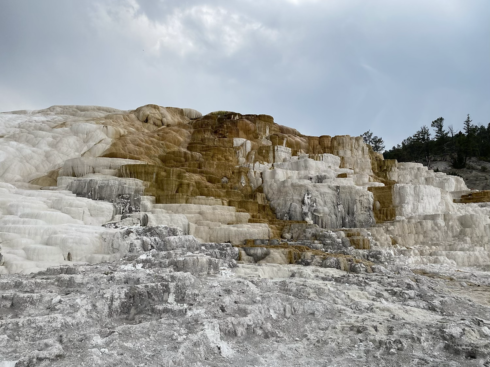
Mammoth Hot Springs - lower terrace, which is walkable

It reeks over here like sulfur but at least you can't tell from looking at us!

View from the upper terrace, which is drivable

Another view of the upper terrace
We then continued into the Geyser Basin area of the park and walked the Artist's Paint Pots trail, which has mud pots, geysers, and steam vents, among other geothermal features. Parking in Yellowstone was a little difficult, and we lost some time hanging out in the car hoping a space would open up, but I'm sure it's worse when the park is open to more international visitors, so I'm not complaining.

Artist's Paint Pots trail

A lot of the paths in Yellowstone are on these raised boardwalks because the ground is so fragile. They don't want people falling through and damaging the ecosystem--or, you know, getting burned by a thermal hot spring.
Bubbling mud pots
Geyser and steam vent
We then explored the Lower Geyser Basin trail, which also has geysers and steam vents and mud pots but also has at least one very pretty prismatic spring, before moving on to Grand Prismatic Spring.

Prismatic Spring in the Lower Geyser Basin

The signs in Yellowstone cracked me up because they're everywhere and they're all THIS URGENT

The illustration on this one killed me
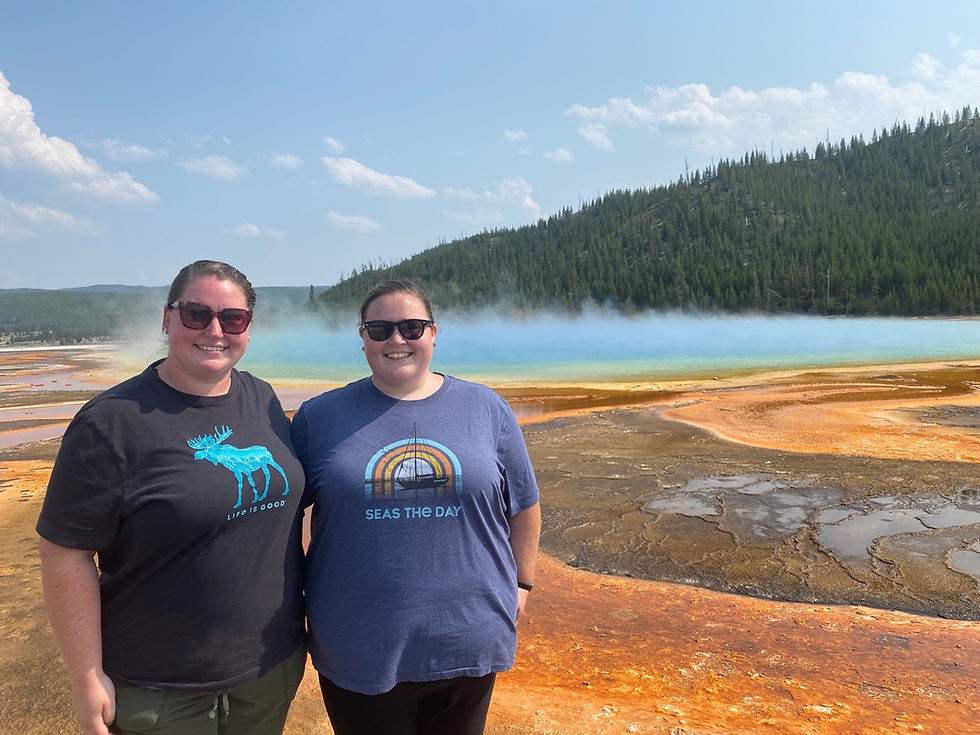
At Grand Prismatic Spring
The best view of Grand Prismatic Spring is from above, so if you're comfortable climbing a lot of stairs, you should definitely do that if you find yourself in Yellowstone (We, obviously, are not, so we were very happy with the view from the bottom).
Reading through our day like this, it sounds like this all took about an hour, but Yellowstone is a pretty massive park so we covered a lot of ground. That said, it was pretty late in the day at this point, so we ended our first day in Yellowstone at Old Faithful. They have staff there who can guess what time it's going to erupt based on geological readings of some sort (clearly science is not my area of expertise) so we waited for a while hoping they were right, and they got the time right within 10 minutes, so we were very impressed.

Old Faithful
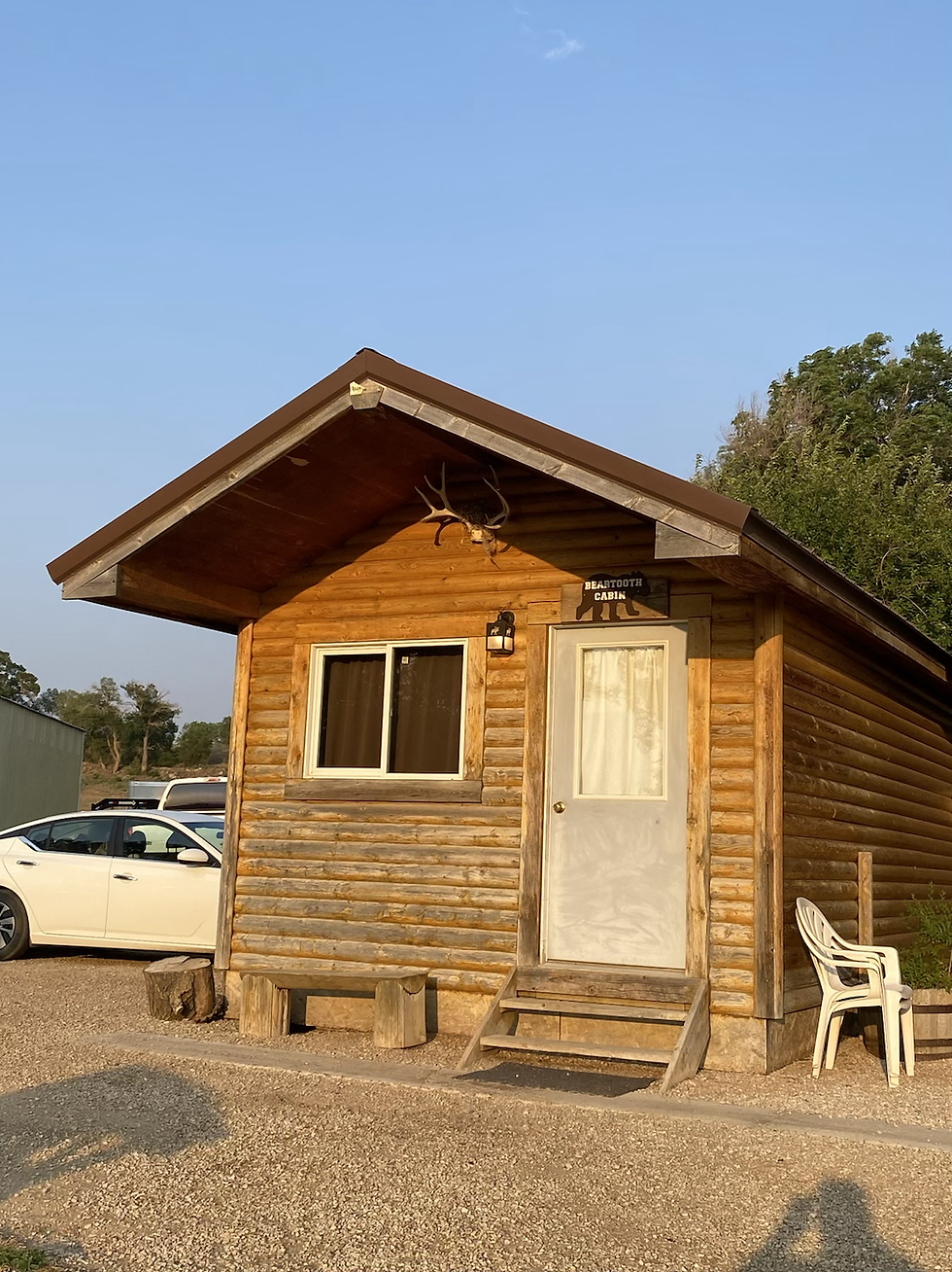
We had a cold picnic dinner near Old Faithful and then left the park for the KOA campground where we were staying. We were upgrading that night and actually stayed in a cabin instead of the tent, so we had real beds! (Full disclosure: only because all the tent sites were taken, both at the KOA and in the national park, but the cabin was very nice!)
We got up while it was still dark the following morning so that we could be in the park for sunrise. We were headed for the Canyon Village section of the park to see the Grand Canyon of the Yellowstone, but on our way there, we actually saw a moose and her baby! I apologize that my photos of them are garbage, as they were pretty far away and I was just using my iPhone, but after so many years of hoping we'd see a moose, it finally came true.

Pathetically, this really is the best photo of the moose that I have, so I circled them below so you can identify them. The white circle is mama moose and the red is baby moose.

We were already flying high from the moose sighting when we got to the canyon and let me just say it was absolutely breathtaking.

View of Grand Canyon of the Yellowstone from Artist's Point

View of Grand Canyon of the Yellowstone from Inspiration Point
Brink of the Lower Falls (Warning: the water is LOUD). This is the closest I've ever been to a waterfall. Totally wild!
We then headed south to the Mud Volcano loop and then our last stop in Yellowstone, Fishing Bridge, before continuing on to Grand Tetons National Park, which is literally 10 away from the southern gate of Yellowstone. We drove into the park, stopping at most of the scenic viewpoints along the way, and drove up Signal Mountain to the overlook up there.
Dragon's Mouth spring on the Mud Volcano trail

Fishing Bridge
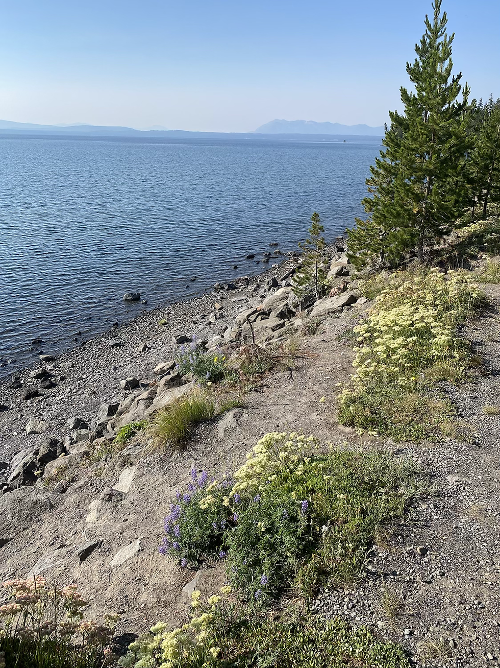
West Thumb of Yellowstone lake
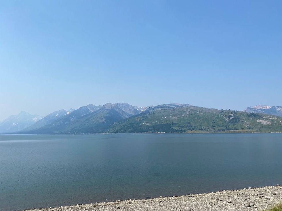
Jackson Lake in Grand Tetons National Park

Oxbow Bend Turnout

I'm pretty sure this is the view from Signal Mountain Lodge but I might be wrong. It's definitely in Grand Tetons lol

Signal Mountain overlook
As I'm sure you can tell from the photos above, distant views were pretty obstructed by the wildfire smoke, which was obviously a bummer. But the incredible thing about Grand Tetons is how close you can get to the mountains themselves, so as we continued on, we had better views just because we got to be so close to the mountains.

Cascade Canyon turnout
We had plans to take the boat across Jenny Lake, but since visibility was pretty poor, we decided to head for our campsite instead and hope that tomorrow would be better. We got set up at Gros Ventre campground within the park and took a power nap since we had been up since before sunrise, then went to explore Jackson, WY. The downtown area was very nice, and we enjoyed walking around for awhile and visiting some shops before we continued on to Teton Village at the Jackson Hole resort. I had made a reservation for dinner at the Piste Mountain Bistro, accessible by gondola, which was really cool.

In downtown Jackson

Gondola at Teton Village

(Smoky) view from the top
A quick funny story about the Piste Mountain Bistro: I had made dinner reservations there because the gondola to the top is free after 5pm, so supposedly the lines to get on the free gondola can take ages. If you have a restaurant reservation, you can skip the line of people who don't have reservations. However, due to the wildfire smoke, there was hardly anybody interested in taking the gondola to the top, so the reservation really didn't matter. We also both ended up hating our food, and we could have just visited the reservation-free Deck @ Piste, which is basically bar food and would've been considerably more affordable than the fancy farm-to-table dinner we had. Hindsight is 20/20, clearly!

Gondola on the way back down

Sunset over the Tetons
We got incredibly lucky in the morning because the smoke had lessened a little, so we got up early and visited Mormon Row, then took the shuttle across Jenny Lake.

I know nothing about science, as I've proven in this post, but I wonder if the smoke lessened a little because it was so cold overnight. It was 44 degrees when I took this photo of Julia basically hiding in her sleeping bag!

Mormon Row, the remains of a Mormon homestead from the late 1800s/early 1900s

Jenny Lake
We then looped back up towards Jackson Lake and came down route 191 south, which was just a different road through the park with different overlooks.

Teton Point Turnout

Schwabacher's Landing

Snake River Overlook
That was our last stop in Grand Tetons, and in Wyoming, as we turned west to cross the border into another new state for us: Idaho!


Comments